

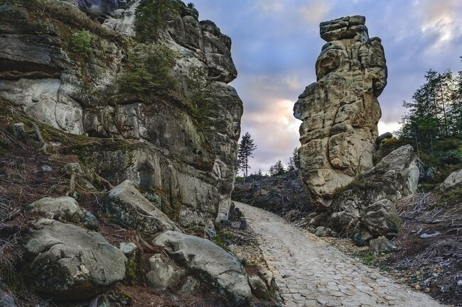
Through the Teplice rock town
The blue markers will take you on a six-kilometre, well-marked tour circuit, which has seventeen informative panels along the way.


The blue markers will take you on a six-kilometre, well-marked tour circuit, which has seventeen informative panels along the way.
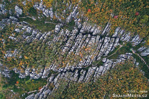
A lonely mesa (table mountain) located between the towns of Teplice nad Metují and Police nad Metují.
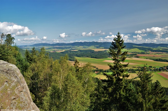
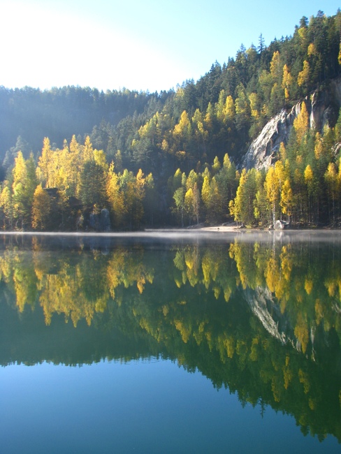
A picturesque valley full of Baroque monuments, stone farmhouses, and natural wonders.
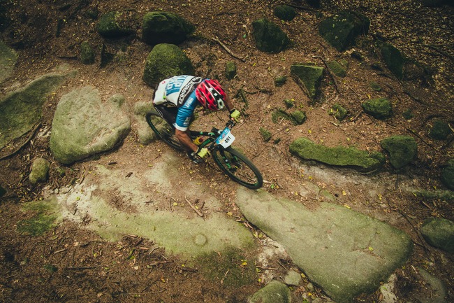
Although you need to be reasonably fit, this technically easy route along the rugged slopes of the Javoří Mountains is one of the most beautiful and interesting scenic biking
A moderately challenging circuit that follows forest trails and roads, through some more remote parts of the Teplice border region. The route is suitable for both fitness riders as
The Pánova cesta is a challenge for truly experienced mountain bikers who can get the most out of the strenuous climbs and the wild, technically challenging descents. Route No. 4003
The biking trail leads along asphalt and paved surfaces suitable for mountain and trekking bikes. A lovely route that passes close by the Adršpach-Teplice Rocks. It includes some really nice

An easy and laid-back circular route along bike trails and roads around the Adršpach Rocks and through the valley of the Dřevíč stream. Route Teplice nad Metují - Střmenské Podhradí - Dolní
An easy crossing route along a farm track and an unpaved dirt road. Route Suchý Důl - Bělý (Bělý - Suchý Důl) Route description The route leads from the crossroads signpost in the middle
An extremely challenging circuit, the route of one of the Czech Republic’s toughest mountain bike races. The permanently marked route crosses the Broumov region from Adršpach Rocks through the
Parkoviště pod Pasy – kaple sv. Huberta – Amerika u Křinic, rozcestník (3, 5 km) – Martínkovice, rozcestník na horním konci obce (9, 5 km) – rozcestník Pod Velkou kupou (10 km) – svážnice pod Korunou – rozcestník Pod Špičákem (13, 5 km) – Pánův kříž, rozcestník (14 km) – (Božanovský Špičák, zajížďka na vyhlídku: +3 km k celkové délce trasy) – Slavný, rozcestník Nad Slavným (17 km)
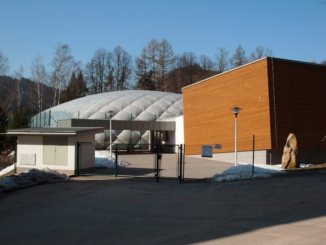
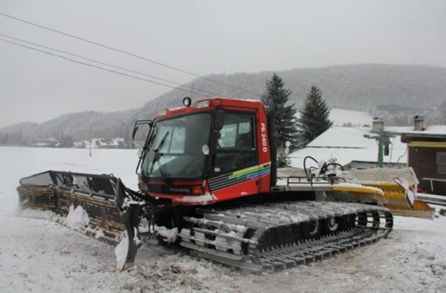
Multi-purpose winter and summer sports facility. The Sports Centre in Teplice nad Metují offers a covered inflatable hall with a 51 x 36 m artificial grass surface. The area can be divided up
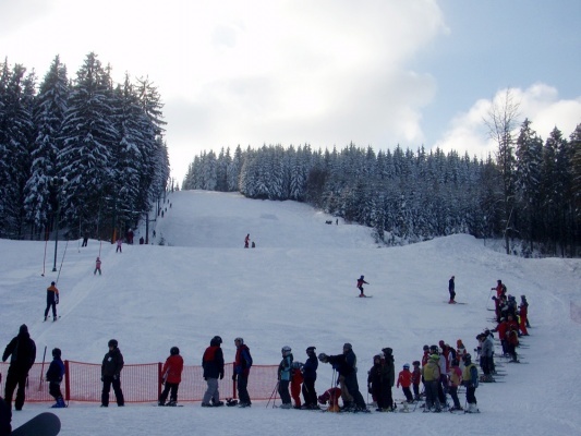
Lyžařský areál se nachází v osadě Studénka spadající pod obec Radvanice v Čechách (okres Trutnov) na severní straně Jestřebích hor v nadmořské výšce cca 550 - 650 m.n.m.
Areál je vhodný jak pro děti a začátečníky, tak i náročnější lyžaře.
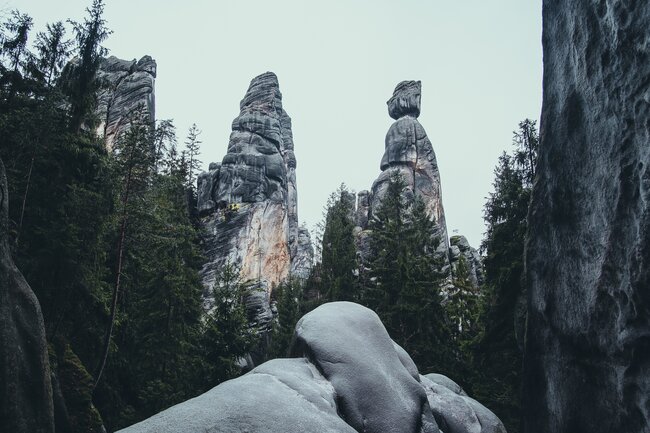
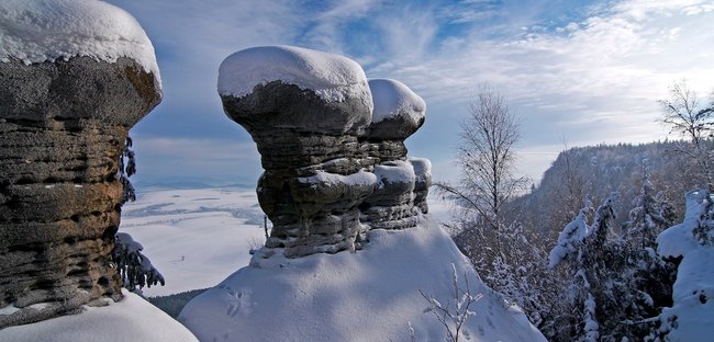
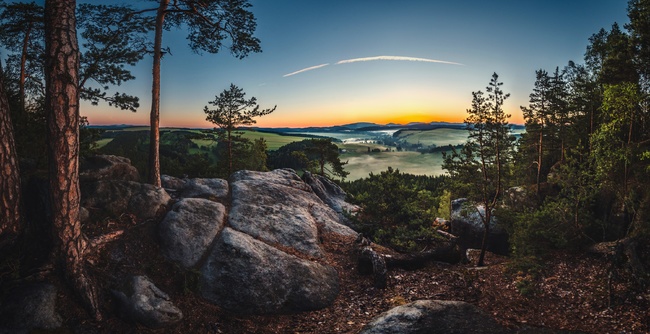
Visit the largest and wildest rock city in Central Europe, which will captivate you with its stunning natural beauty.
.jpg)
Teplice Rocks - National Nature Reserve
A lonely mesa (table mountain) located between the towns of Teplice nad Metují and Police nad Metují.
.jpg)
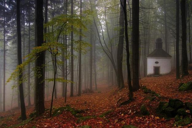
The Broumov is home to many magical places that are well worth visiting whatever the season.
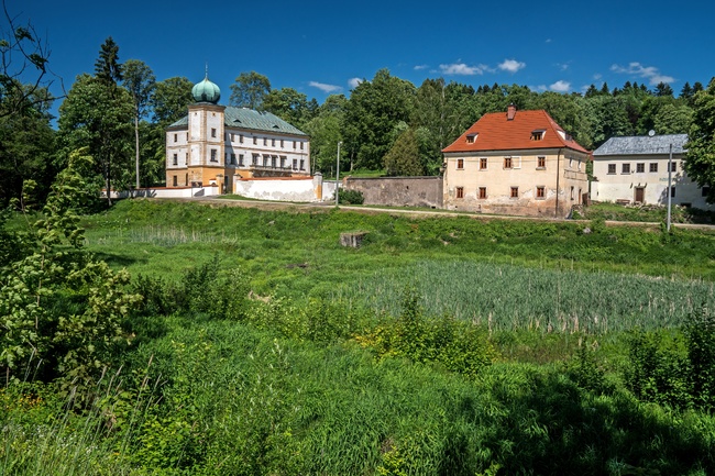
A picturesque valley full of Baroque monuments, stone farmhouses, and natural wonders.
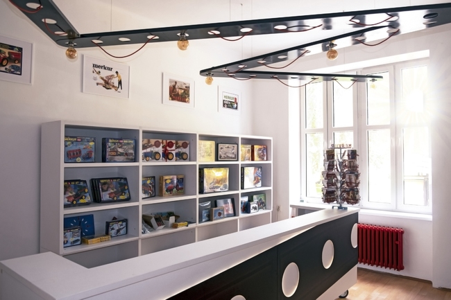
The unique Czech construction kit museum with a long tradition.
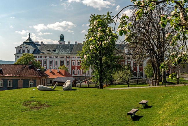
Visit the Benedictine monastery right in the heart of Broumov.
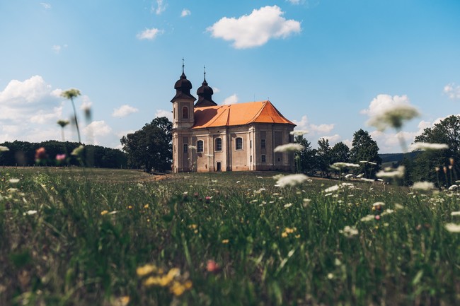
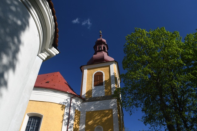
The Broumov Group of Churches is a unique set of Baroque sacred buildings harmoniously integrated into the Broumov region’s landscape
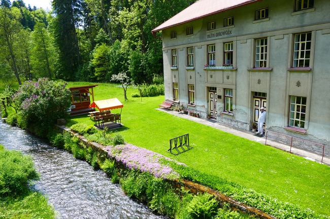
Visit the Milling Museum with its water sprite, bear and devils.
Exposition of mountaineering The first mountaineering museum in the Czech Republic is located in the Adršpach Baroque chateau. The exposition introduces sandstone climbing, which is inseparable from the Adršpach-Teplice rocks.
Od letošního roku se Geopark Broumovsko zařazuje se svým pořadovým číslem 9 do seznamu českých národních geoparků jako další výjimečné geologicko-historicko-kulturní území České republiky. Geopark v tomto pojetí není novým
Naše webové stránky používají cookies. Pomáhají ke správné funkci stránek a lepšímu uživatelskému zážitku. Využíváním našich služeb s jejich používáním souhlasíte.

.svg)
.svg)
.svg)
.svg)

.svg)